


Why Toronto and Ottawa feel stuck in a lingering spring
As of Tuesday, June 10, 2025, many residents across Toronto and Ottawa are wondering why summer warmth still feels so distant, despite the calendar suggesting otherwise. While other areas in Southern Ontario have experienced brief glimpses of hot weather, both cities seem locked in a stubborn spring-like chill.
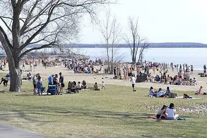
Lake Ontario’s influence: A cool breeze culprit
The primary suspect behind Toronto’s sluggish warm-up is Lake Ontario. The current lake surface temperature hovers around 15 °C (59 °F). With any east or southeast wind, this cooler air is dragged inland, dampening daytime highs across the Greater Toronto Area (GTA).
By late spring, the temperature contrast between the still-cold lake and warming land generates a frequent lake breeze. This onshore flow maintains a cool microclimate across much of the urban core and nearby communities, especially during what should be the beginning of a true summer ramp-up.
Persistent upper-level trough: A blocking pattern overhead
Beyond the local chill, the larger atmospheric picture explains why neither Toronto nor Ottawa has held onto any lasting heat. A quasi-stationary upper-level trough has anchored itself over Ontario. This trough acts like a magnet for unsettled weather, with areas of low pressure repeatedly developing and ushering in persistent cloud cover, light showers, and unfavourable winds from the east.
Since May 16, Toronto has recorded precipitation on 60% of the days, with no stretch of more than two consecutive dry days since May 10–12. In Ottawa, the pattern has been similarly dreary, with nearly 60% of days since May 14 bringing rain, and the heaviest occurring in the second half of May.
Elusive summer highs: Just one 30-degree day so far
Only June 4 has brought the 30 °C (86 °F) benchmark to Toronto and Ottawa. For context, Ottawa typically sees 15 such days each year, and Toronto averages around 17. These early numbers reflect a slow and stubborn start to the warm season.
Though short-lived ridges have managed to nudge warmer air into the region briefly, they have failed to dislodge the persistent cool trough, meaning any warm spells quickly dissolve.
Wildfire smoke: A hidden cooling factor
Another critical and often overlooked factor contributing to the suppressed warmth is wildfire smoke. On June 7, satellite imagery showed a thick veil of smoke across Ontario, likely settling at the surface.
This smoke layer can lower temperatures by 3 °C to 4 °C (5–7 °F) by reducing solar radiation by up to 25%. The result is a muted heating effect, even when skies appear relatively clear.
Outlook: Will warmth return soon?
Meteorological models continue to monitor for pattern changes, but as of today, the dominant factors—Lake Ontario’s chill, persistent upper-level troughs, and widespread smoke—are all still in play. Residents in Toronto and Ottawa may need to wait a little longer for the true embrace of summer heat.


