

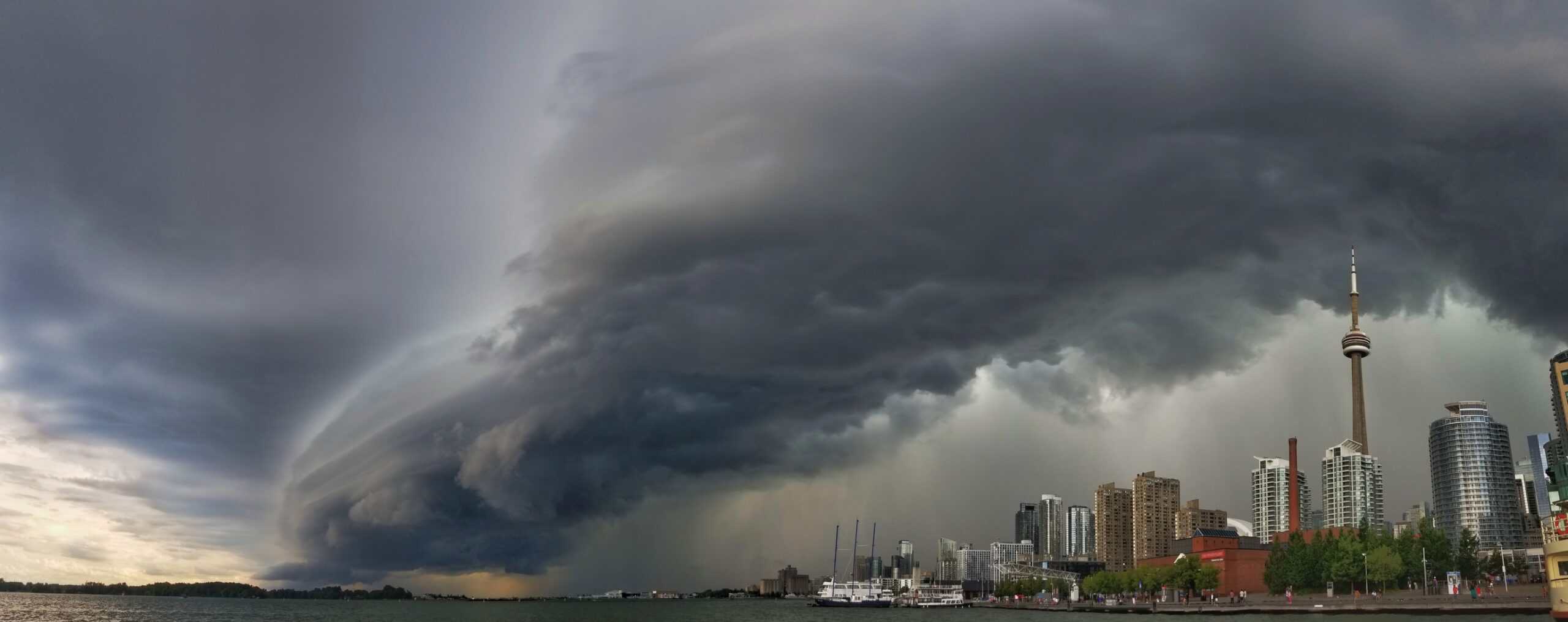
Weather alert for Southern Ontario this Monday
Southern Ontario is expected to experience unstable weather conditions on Monday, June 30, threatening to disrupt Canada Day long weekend plans for thousands across the province. After a pleasant and calm Sunday, a strong shift in atmospheric dynamics will bring the risk of severe thunderstorms, particularly during the afternoon and early evening hours.
Warm, humid air and cold front clash over Ontario
As a warm front lifts northward, it will drag humid air masses into Southern and Northeastern Ontario, creating favourable conditions for the development of intense thunderstorms. The region will experience a surge in atmospheric moisture, combined with daytime heating and an approaching cold front, setting the stage for severe weather.
The area at greatest risk includes Windsor, London, Barrie, Sudbury, and Parry Sound, stretching into the Greater Toronto Area. These areas may see thunderstorm clusters that could deliver very strong wind gusts, large hail, and potentially localized flash flooding.
Storms most likely between 2:00 p.m. and 8:00 p.m.
The exact timing of the storms will depend on the progress of the cold front, but the window of highest risk currently spans from 2:00 p.m. to 8:00 p.m. on Monday. Heavy rainfall rates under the strongest cells could exceed 30 mm per hour, which, when combined with saturated soils, raises the possibility of urban flooding, particularly in low-lying areas.
Holiday outdoor plans at risk across Ontario
With Canada Day celebrations planned across parks, cottages, and campgrounds, it’s vital to be prepared for sudden changes in the weather. Lightning, damaging winds, and hail could all occur with little warning. Storms of this type have the power to knock down trees, disrupt power lines, and create dangerous travel conditions.
If you hear thunder, you’re close enough to be struck by lightning.
Residents are strongly encouraged to stay near a safe indoor shelter and to have real-time access to severe weather alerts, especially if planning to be outside on Monday afternoon.
Driving during or after storms may become hazardous, especially if roadways flood. Just 15 to 30 centimetres (6–12 inches) of moving water is enough to sweep a vehicle off the road, particularly in rural and cottage regions where roads may be less maintained.
Plan ahead, monitor the skies, and expect volatile conditions across Southern Ontario heading into the final day of the June–July long weekend.


