Southern Ontario braces for a genuine summer preview
As of Tuesday, June 3, parts of southern Ontario—including Toronto, Windsor, Ottawa, and even Montréal, Quebec—are poised to experience their first true burst of summer warmth, with daytime highs expected to reach or exceed 30°C (86°F). It’s a welcome milestone after a spring season marked by lingering chill and below-normal temperatures, especially throughout May.
A warm and muggy air mass is spreading across the region, pushing humidex values into the low to mid-30s (91°F–95°F). With light winds and mainly clear skies, Tuesday and early Wednesday are expected to deliver the warmest stretch of weather so far in 2025.
Hazy skies could hold temperatures back
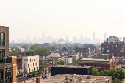
However, not all locations are guaranteed to hit the 30-degree mark. A key wildcard in the forecast is the ongoing wildfire smoke, which continues to impact air quality across much of Ontario and Quebec. If the smoke concentration is dense enough, it may block some of the sun’s energy, keeping daytime highs just shy of 30°C, particularly in parts of the Greater Toronto Area (GTA).
Rain and thunderstorms approach midweek
The heat won’t last long. Between Wednesday evening and Thursday, a frontal system is expected to bring widespread showers and a chance of thunderstorms. This pattern shift will result in a quick cooldown, along with increasing cloud cover and humidity.
Summer’s here—but not to stay, just yet
While this may feel like the first real taste of summer for many in eastern and southern Ontario, the forecast still reflects the instability of the current season. Lingering smoke, intermittent clouds, and incoming rain all remind us that true summer weather hasn’t fully settled in yet.
Stay tuned to The Weather Network for up-to-date coverage across Ontario, Quebec, and surrounding regions.


